


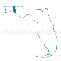
GASKIN-Voting District, Walton County, Florida
About
Outline

Summary
| Unique Area Identifier | 560169 |
| Name | GASKIN-Voting District |
| County | Walton County |
| State | Florida |
| Area (square miles) | 43.16 |
| Land Area (square miles) | 40.72 |
| Water Area (square miles) | 2.44 |
| % of Land Area | 94.34 |
| % of Water Area | 5.66 |
| Latitude of the Internal Point | 30.93713180 |
| Longtitude of the Internal Point | -86.15812320 |
Maps


Graphs
Select a template below for downloading or customizing gragh for GASKIN-Voting District, Walton County, Florida


Neighbors
Neighoring Voting District (by Name) Neighboring Voting District on the Map
- CANEY-Voting District, Walton County, FL
- DARLIN-Voting District, Walton County, FL
- Florala -Boles Mill, Covington County, AL
- GLENDA-Voting District, Walton County, FL
- Hacoda-Flat Creek, Geneva County, AL
- LIBERT-Voting District, Walton County, FL
- LIMEST-Voting District, Walton County, FL
- PAXTON-Voting District, Walton County, FL
Top 10 Neighboring County Subdivision (by Population) Neighboring County Subdivision on the Map
- Paxton-Darlington CCD, Walton County, FL (9,264)
- Samson CCD, Geneva County, AL (5,098)
- Florala CCD, Covington County, AL (3,684)
Top 10 Neighboring Unified School District (by Population) Neighboring Unified School District on the Map
- Walton County School District, FL (55,043)
- Covington County School District, AL (22,091)
- Geneva County School District, AL (20,500)
Top 10 Neighboring State Legislative District Lower Chamber (by Population) Neighboring State Legislative District Lower Chamber on the Map
- State House District 5, FL (154,014)
- State House District 87, AL (46,299)
- State House District 92, AL (40,506)
Top 10 Neighboring State Legislative District Upper Chamber (by Population) Neighboring State Legislative District Upper Chamber on the Map
- State Senate District 2, FL (449,902)
- State Senate District 29, AL (136,679)
- State Senate District 31, AL (129,622)
Top 10 Neighboring 111th Congressional District (by Population) Neighboring 111th Congressional District on the Map
Top 10 Neighboring Census Tract (by Population) Neighboring Census Tract on the Map
- Census Tract 501, Geneva County, AL (5,098)
- Census Tract 9630, Covington County, AL (3,684)
- Census Tract 9501.02, Walton County, FL (3,045)